
You haven’t really seen Tallulah Gorge unless you’ve hiked [or walked] both the North Rim Trail and the South Rim Trail.
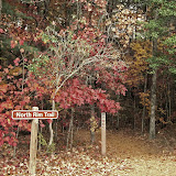
If you begin your Gorge visit at the Interpretive Center, it’s likely you’ll start with the North Rim Trail. Since it’s right out back!
Click here for CarolinaConsidered’s interpretation of that trail, if you haven’t seen it already.
 For me, the South Rim Trail was a very different experience. Not better or worse; just different. So be sure to reserve time for both during your visit.
 There are at least two ways to approach the South Rim Trail. The quickest would be from the end of the North Rim Trail, the one closest to the Route 441 bridge.
 Just keep walking. And you’ll see a sign directing you to steps that will take you to the bridge’s sidewalk, and on over to the other side.

This bridge, by the way, is the second to span the gorge here, replacing one that opened in 1939. Before that, traffic on the way to Atlanta were forced onto the one-lane track on the top of the dam itself!  A long-time friend raised in Western North Carolina recalls family auto trips to Atlanta in pre-bridge days. They sometimes had to drive across the top of this dam in the dark, scared to death that some huge truck would enter the path on the other side, forcing them to back precariously to the end of the dam. On one side they risked a slide into Tallulah Falls Lake; on the other a longer drop down the side of the dam and into the Gorge. Oh my!
 I chose a different approach to the South Rim Trail, however. Driving the next day over to the Day Use Area on the shore of Tallulah Falls Lake. It’s certainly possible to hike both trails in one day. Or even half a day. But what’s the advantage of that? I’d recommend a slower pace that will allow you to enjoy the spectacular views along both trails. True, they’re both only about 3/4 miles in length. And fairly level. But I took over three hours on each and certainly had a better time.
 I found plenty of parking in the Day Use Area. A construction crew was building a new comfort station beside the lake. All sorts of colorful equipment!
 The beach here was closed during my visit. But a click on the photo above will give you an idea of what you’ll find once the trail there reopens.
 Walk back up the Day Use Area hill, across the bridge, and over to the entrance of the South Rim Trail.
 From there it’s one spectacular scene after another. It’s impossible to resist the temptation to see what’s beyond the next turn in the trail. I did manage to resist the temptation to descend these wooden stairs that lead to the suspension bridge across the Gorge.
 Look at this! 680 steps down; and 680 steps back up. Beyond my ElderHiker capabilities. But what a view it must be! Maybe some day …
There’s much more to see here. But again, we’re running out of time. Since Picasa photo folder links seemed to work well in previous posts, I’ll add another here. Just click the “Slideshow” button near the upper right of the screen and enjoy.
So there you have it. A visit to Georgia’s Tallulah Gorge State Park. A considerable distance from Columbia, South Carolina. But worth it!




 Posts
Posts

